Mount Pleasant is the Lowcountry's biggest suburb and its most energetic one: a
town of historic villages, booming master plans, Shem Creek shrimp boats, and
some of the region's best schools, all across the Ravenel Bridge from downtown.
This guide covers the town's character, neighborhoods, commute, local businesses,
parks and the harbor, schools, events, and the aging-in-place questions buyers ask
most.
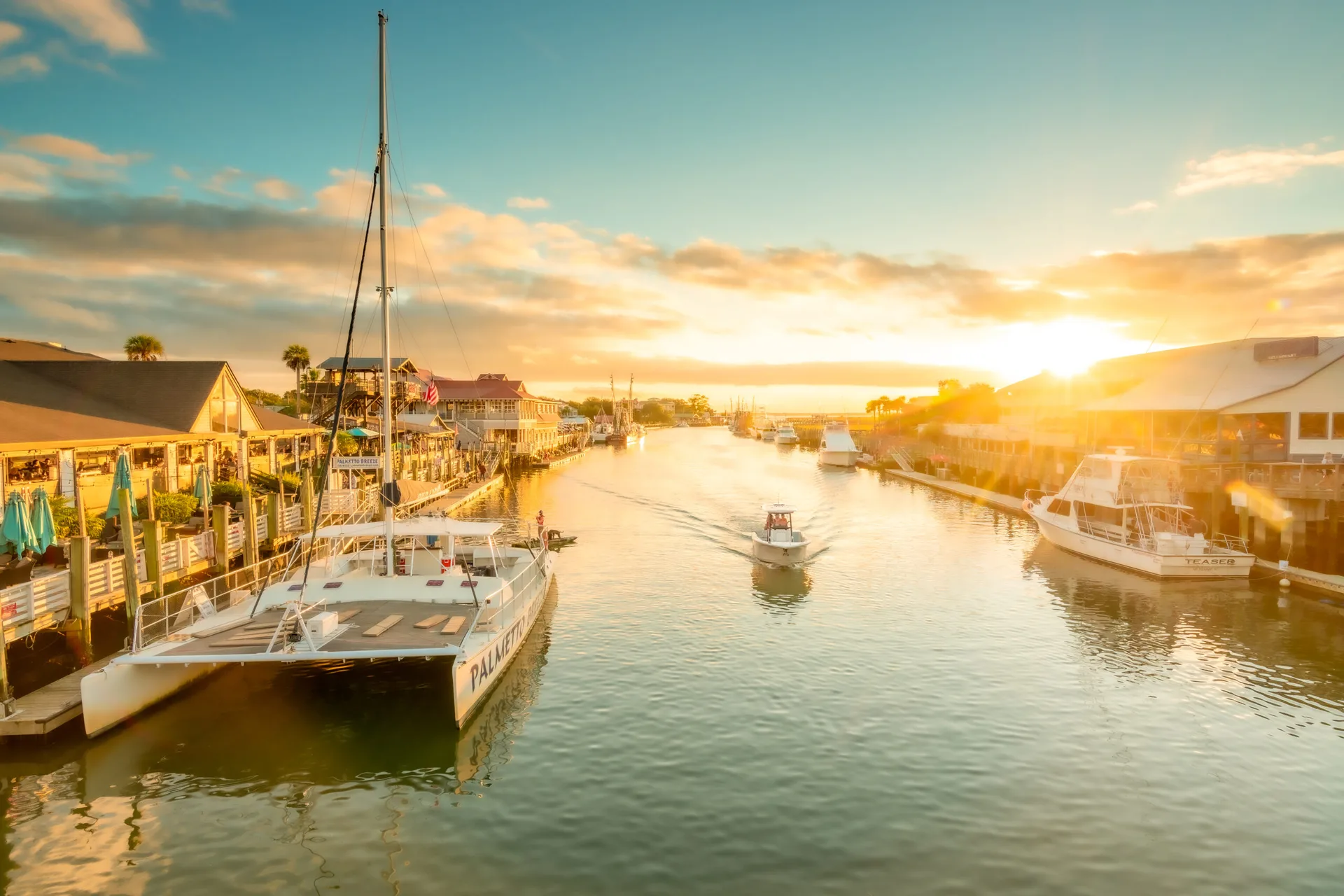
Shem Creek at sunset, docks and dinner spots lining the waterThe Local Guide · Mount Pleasant
The Town
What is Mount Pleasant really like?
A big, busy, family-forward town with a serious old-roots heart and a new-town
energy that keeps it growing.
Mount Pleasant began as a small harbor-adjacent village across the Cooper River
from Charleston, and it has grown into one of South Carolina's largest towns,
roughly 90,000 residents spread from the Old Village waterfront to master-planned
communities along the Wando River. The growth has been deliberate and constant:
new schools, new parks, new shopping, and new neighborhoods that keep arriving,
which makes it the default answer for families relocating to Charleston.
What keeps it from feeling like a generic suburb is the water. The harbor, Shem
Creek, and the Wando River wrap the town in working waterfront: shrimp boats still
unload at Shem Creek, kayakers share the creek with dolphins, and the Mount
Pleasant Pier and Memorial Waterfront Park sit under the great bridge. Add the
Old Village's historic streets, I'On's porches, and a shop-and-dine scene from
Coleman Boulevard to the Towne Centre, and you get a town with real texture under
all the growth.
~90,000
Residents, making Mount Pleasant one of the state's largest municipalities
2005
The Arthur Ravenel Jr. Bridge opened, replacing the old Grace Memorial spans and tying the town to the peninsula
2.5 mi
Length of the Ravenel Bridge, among the longest cable-stayed spans in the Western Hemisphere
The Communities
Where do people live in Mount Pleasant?
Three settings anchor most buyer conversations, with a dozen more communities
filling the range between them.
No. 01 · Community
The Old Village
Historic charm on the harbor
The Old Village is Mount Pleasant's founding heart, a walkable grid of historic homes and cottage gardens around Church Street, Pitt Street, and the harbor, with the Alhambra Hall pavilion overlooking the water.
Historic homes and deep Charleston character in the Old Village
Harbor views, Pitt Street shops, and the Alhambra Hall lawn
No. 02 · Community
I’On
A new-urbanist village inland
A short drive inland from the waterfront, I'On is a nationally admired new-urbanist community of porches, alleys, and a town center, built in the Old Village's well-mannered spirit.
I’On’s walkable, porch-forward planning with a real town center
No. 03 · Community
Park West & Dunes West
The big, amenity-rich family communities
North of the IOP Connector, Park West is one of the area's largest planned communities, with pools, parks, miles of sidewalks, and recreation fields wrapped around a lake. Dunes West adds a golf course, equestrian center, and marina on the Wando River. These are the neighborhoods families mean when they say they want everything close: schools, sports, shopping, and neighbors their kids' age.
Pools, parks, trails, and recreation fields in Park West
Golf, equestrian, and Wando River marina at Dunes West
Some of the area’s most active youth-sports communities
No. 04 · Community
Carolina Park
New master-planned community on the mainland side
Carolina Park, built around a town-center plan with shops, a market, and trails, has become the reference point for new Mount Pleasant: newer homes, a genuinely walkable commercial core, and a school in the neighborhood.
Town-center amenities and newer construction in Carolina Park
No. 05 · Community
Belle Hall
Established streets by Long Point Road
Belle Hall, closer in along Highway 17, pairs established, family-friendly streets with the convenience of the Belle Hall shopping center, which keeps the errands close.
Established streets with quick access to the Belle Hall shops
More communities
Beyond those three, the town holds a wide range: the beach-road neighborhoods of
Snee Farm and Hamlin Plantation near the IOP Connector, the newer village plans of
Bolden Lake and Rivertowne country, the established streets of Seaside Farms and
Hidden Cove along the Wando, and the town's dense, walkable new centers around
Carolina Park. Buyers usually narrow the field by school zone first and by commute
second, and Mount Pleasant's growth has made both questions matter more every year.
No. 06 · Community
Snee Farm
A beach-road neighborhood near the IOP Connector, one of the town's established
beach-side settings.
No. 07 · Community
Hamlin Plantation
A beach-road neighborhood near the IOP Connector, close to the beach routes and
the town's main spines.
No. 08 · Community
Bolden Lake
One of the town's newer village plans.
No. 09 · Community
Rivertowne
One of the town's newer village plans, in the Rivertowne country.
No. 10 · Community
Seaside Farms
One of the town's established neighborhoods along the Wando River.
No. 11 · Community
Hidden Cove
Established streets along the Wando River, part of the town's settled
river-side neighborhoods.
No. 12 · Community
Carolina Park
One of the town's dense, walkable new centers, built around a town-center plan
with shops, a market, trails, and a school in the neighborhood.
The Location
How far is Mount Pleasant from downtown Charleston?
About 15 minutes over the Arthur Ravenel Jr. Bridge, the postcard-perfect
cable-stayed span that carries US-17 across the Cooper River to the peninsula.
The bridge opened in 2005 and replaced the aging Grace Memorial and Silas Pearman
spans, ending decades of white-knuckle commutes. Downtown is now a straight, wide
shot over the water, with the skyline filling the windshield.
The rest of the map: I-526 crosses the river's northern arc toward North
Charleston and the airport, Highway 17 runs north toward Sullivans Island and the
IOP Connector, and the Isle of Palms Connector (SC-517) plus Ben Sawyer Boulevard
carry the beach traffic. Rush hour compounds at the bridge approaches and along
Coleman Boulevard, the honest trade for living on the town side of the water.
Roads to know
The Ravenel Bridge (US-17)
The town's front door to downtown: two-and-a-half miles of cable-stayed span over the Cooper River.
Coleman Blvd & Hwy 17 N
The town's main spines, running the length of Mount Pleasant toward the beach roads.
Isle of Palms Connector (SC-517)
The direct route to the IOP and Sullivan's Island, branching off Highway 17.
I-526
The beltway north to North Charleston, the airport, and the West Ashley/James Island bridges.
The Local Scene
Local businesses & restaurants
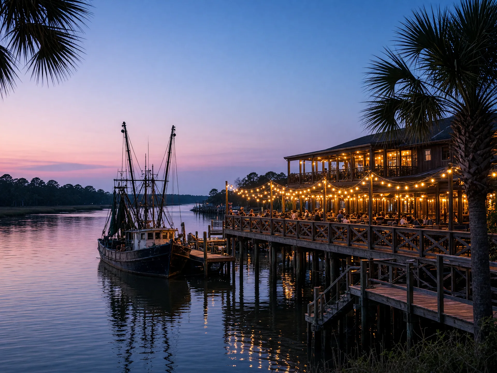
Mount Pleasant's dining story is written on two stages: the Shem Creek waterfront,
where restaurants crowd the boardwalk within arm's reach of the shrimp boats, and
the Coleman Boulevard corridor, where the town's long-running institutions live.
A handful of well-loved spots, in no particular order:
Dinner on the creek, boats at the dockPlate · No. 01
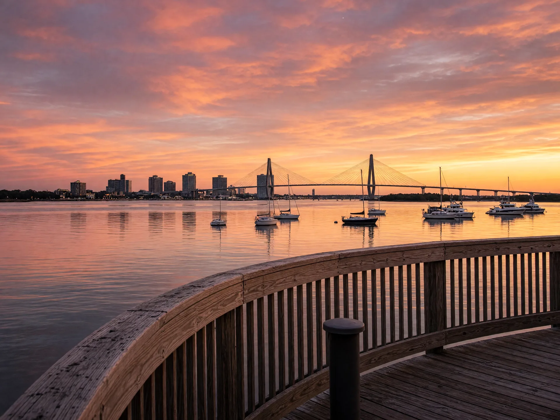
The pier at sunset, under the bridgePlate · No. 02
The Outdoors
What is there to do outdoors?
The water is the whole point. Shem Creek is the town's outdoor living room: a
boardwalk for walking, docks for watching the shrimp boats and dolphins, and
outfitters sending kayakers and paddleboarders into the creek. The Mount Pleasant
Pier at Memorial Waterfront Park runs hundreds of feet out under the Ravenel
Bridge, with a playground, lawn, and the best free skyline view on the east side
of the harbor.
History and parks round it out. Patriots Point Naval & Maritime Museum
berths the aircraft carrier USS Yorktown and a Cold War submarine within sight of
downtown, and Boone Hall Plantation, one of America's most photographed working
plantations, sits on the town's northern edge with its famous Avenue of Oaks.
Palmetto Islands County Park adds trails, a waterpark, and a dog park, and the
beaches of Sullivan's Island and the Isle of Palms are 15 minutes down the road.
For families, the town's recreation department runs one of the region's deepest
youth sports calendars.
A broad, honest read on what homes in the town typically trade for, based on
public listing and sale data. Treat these figures as a guide rather than a quote.
Typical single-family range
$750,000 to $1.5 million
Most Mount Pleasant single-family sales have run with a median around
$880,000 to $940,000 in recent years.
Approximate market estimate. Typical range as of late 2026, per public listing
data. Established waterfront neighborhoods in lower Mount Pleasant run higher;
newer communities toward the northern end of town sit lower.
The Community
What schools serve Mount Pleasant?
Mount Pleasant sits in the Charleston County School District's Moultrie
Constituent District, with its own elementary, middle, and high schools, and it
is widely sought by families for exactly that reason. Attendance zones split the
town, so confirm the feeder pattern for the exact address; lines have shifted
with the town's growth.
Community life runs on schools, sports, and the water: packed rec fields on
Saturdays, the farmers market on Coleman Boulevard through the season, holiday
events at the Towne Centre and down the parade route, and the creek-side rhythm of
July evenings. It is a town built for raising kids and staying active, and the
social calendar rarely pauses.
On the Calendar
Upcoming events in Mount Pleasant
Late November and December in Mount Pleasant are a near-continuous run of tree
lightings, markets, and the town's famous Christmas parade. Dates and lineups can
shift, so confirm with the organizer before you go.
Event No. 01
Old Village Harbor 5K
Saturday, Nov 14, 2026, 8:30 a.m.
Pitt Street, Old Village
The annual community race through Mount Pleasant's historic Old Village, a run that doubles as a neighborhood gathering on the harbor side of town.
The official lighting of the 44-foot tree with a laser light show, live music, Santa visits, face painting, and food vendors, the town's unofficial start of the season.
A winter-wonderland family event on the working farm: fresh-cut trees and wreaths, live music, rides, cookie decorating, letters to Santa, and marshmallow roasting, with free admission.
The town's signature holiday night: a fireworks kickoff at Moultrie Middle School, then marching bands, glowing floats, and Santa on a fire truck down Coleman Boulevard.
Yes, and the town has invested in making it genuinely workable. Newer communities
routinely build first-floor owner suites, the Mount Pleasant Senior Service Center
on Von Kolnitz Road runs programs for adults 50 and older with a fitness room,
classes, and a garden, and the flat boardwalks at Shem Creek and the pier make
daily walking easy.
The universal design details that matter most: a step-free entry, a bedroom and
full bath on one level, doorways that clear a walker or wheelchair (a 32-inch
opening is the practical benchmark), lever handles, low-threshold showers, and
even lighting. Older historic homes and waterfront builds are the two places to
check stairs carefully; newer stock more often has the basics already in place.
Care is close. Roper St. Francis Mount Pleasant Hospital on Highway 17 North runs
a geriatric-certified emergency department, and Novant Health East Cooper Medical
Center on Hospital Drive is the town's other full-service hospital, with MUSC and
the downtown campuses a bridge away. Having real hospital care inside the town
limits is a major part of why so many families settle parents here.
A level walk with a skyline viewPlate · No. 03
Tapley's lens
Families who look at Mount Pleasant through a universal-design lens often find
the same features that support aging today support resale tomorrow. Tapley helps
buyers tour with these questions in hand, and helps sellers spotlight the
one-level, step-free features they already have.
The Fine Print
What should buyers & sellers know first?
Mount Pleasant is one of the region's most competitive markets, and it rewards
preparation. These notes come up in nearly every transaction here.
No. 01
Traffic is the town’s biggest topic
Highway 17 and Coleman Boulevard carry nearly all cross-town traffic, and rush hour is genuinely slow, especially over and under the bridges. Buying close to your commute corridor is the single best hedge, and the town's road projects are a constant, slowly improving story.
No. 02
Flood risk follows the creeks
Homes near the harbor, the Wando River, Shem Creek, and the tidal creeks carry real flood exposure, and FEMA maps vary street by street. Check the flood map and insurance cost for the exact address; interior communities sit lower-risk.
No. 03
Schools split by zones
Mount Pleasant was rezoned around two large high schools, and attendance lines matter a great deal to buyers with school-age kids. Confirm the exact feeder pattern for the address before you fall in love, since adjacent streets can differ.
No. 04
Short-term rentals are tightly regulated
Mount Pleasant restricts short-term rentals more strictly than many beach towns, which protects neighborhood character but matters to anyone weighing rental income. Understand current rules before you count on one.
No. 05
One-level living is findable but priced
Newer communities increasingly build first-floor owner suites, and the town has real ranch inventory in older pockets. For aging-in-place buyers the options exist, but they move quickly and command attention, which is where working with someone who knows the inventory matters.
The Conversation
Buying or selling in Mount Pleasant? Let's talk.
Whether you are drawn by the Old Village, the new master plans, the schools, or a
single-level home that will carry you into the next chapter, Tapley knows this town
and the questions that matter here. Call
843-345-8277
or email
tapley@tapleybaxter.com
to start the conversation.